Maps of Walworth, Downham
and Tooting.
Showing Westmoreland Road, Walworth, SE17 and Rangefield Road, Downham, Kent, in the 1950’s, with Glasford Street, Tooting, SW17, in the 1980’s.
Westmoreland Road, Walworth.
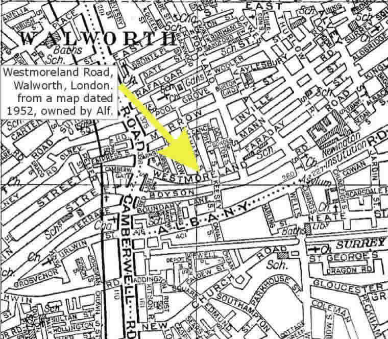
Use Google Maps to see the same map of Westmoreland Road.
Rangefield Road, Downham, Kent.
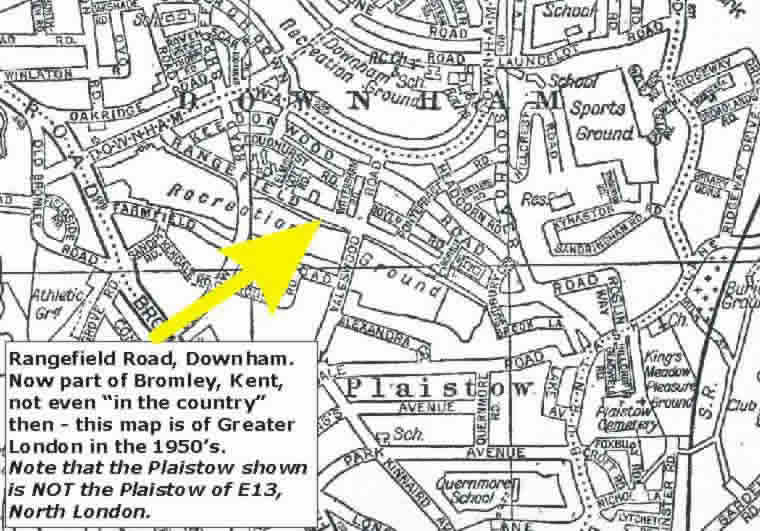
Use Google Maps to find the same map of Downham (Bromley), Kent.
Glasford Street, Tooting.
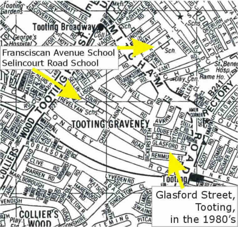
Use Google Maps to find the same map of Tooting (Wandsworth).
Maps of West Ewell and North Cheam.
Showing Poole Road, West Ewell in 2003, and North Cheam in the 1980’s.
No longer “in the country”…
Poole Road, West Ewell.
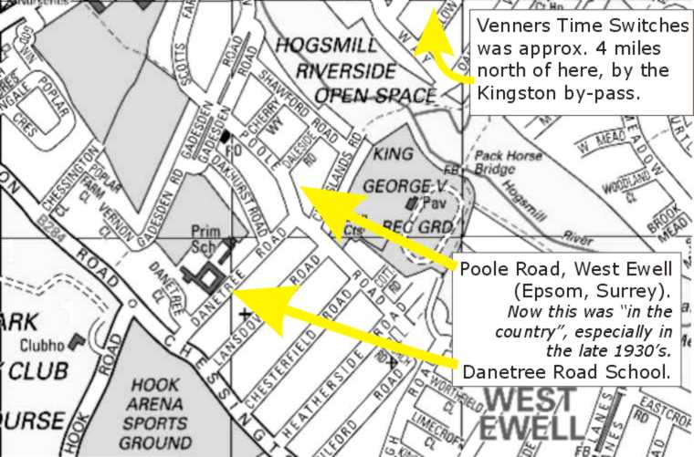
Danetree Road School remains in 2003, as does the “Hogsmill River” open space. Maps of this area don’t form part of the London A-Z in the 1950’s and 1980’s, hence the use of a 2003 map.
Use Google Maps to see the same map of West Ewell (Epsom)
North Cheam – almost Worcester Park.
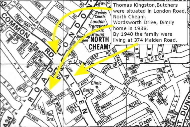
It must have been much more convenient for Alf to go to work for Kingston’s butchers here in North Cheam, rather than cycle to Venners in New Malden.
Alf’s family remained around this area – Sutton, Cheam, New Malden, Worcester Park and nearby Wimbledon – for many more years, including into the 2000s.
Use Google Maps to see the same map of North Cheam (Sutton)
Maps of Greenwich and Woolwich, south London.
Showing Crooms Hill, Greenwich and Shooters Hill, Woolwich in the 1950’s, plus the location of the “Sun” Public House.
Crooms Hill, Greenwich.
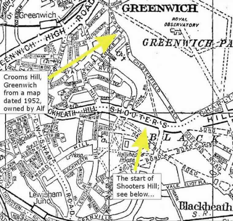
A 1950’s map of south London, showing the location of Crooms Hill in Greenwich, where William George Allen was living at the time of the 1881 Census.
Use Google Maps to see the same map of Crooms Hill, Greenwich.
Shooters Hill, Woolwich.
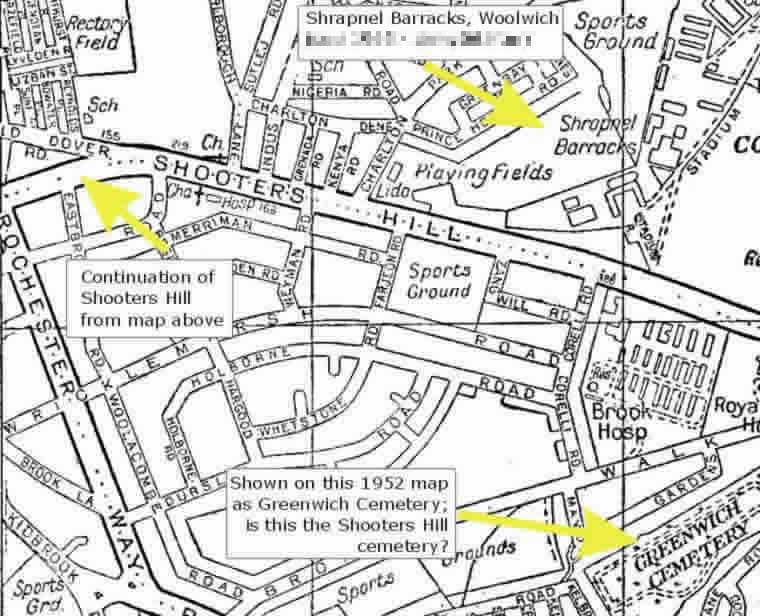
Shooters Hill, Greenwich/Woolwich, showing the Greenwich cemetery – is this the Shooters Hill cemetery?
The map also shows the location of Shrapnel Barracks in Woolwich, where Alf was stationed briefly before and then after his return from India.
Use Google Maps to see the same map of Shooters Hill, Greenwich.
The location of the “Sun” Public House, Greenwich.
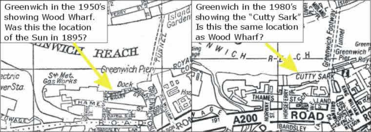
To the north of Crooms Hill is the modern location of the Cutty Sark, which my dad believed to be close to the location of the “Sun” public house. These two maps show this area in the 1950’s and again in the 1980’s.